
Lauʻī-pala
Yellow tang
Solid lemon yellow. Impossible to mistake for anything else.
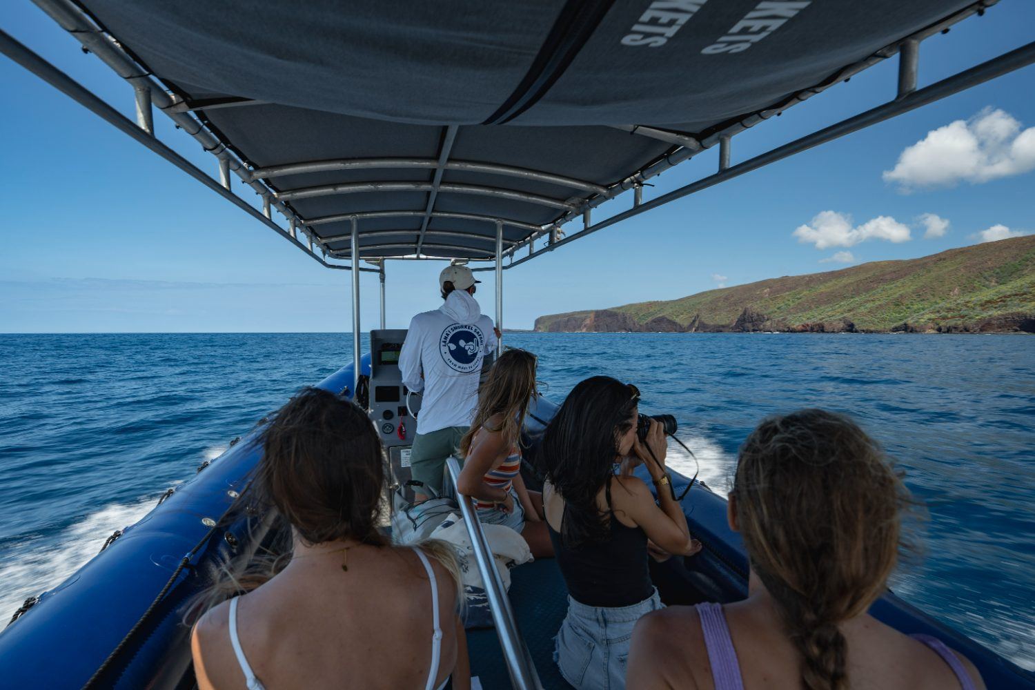
Lānaʻi is the smallest of Hawaiʻi’s publicly inhabited islands, and its southern and western coastline has no road along it. There are cliffs, sea caves, arches and sea stacks that you can only reach by boat — which is why the water is clear and the reefs are intact.
Maui’s roadside snorkel spots are good. They are also full. When we cross the ʻAuʻau Channel from Kaʻanapali, we are usually the only raft on the reef, and the crew picks the stop that morning based on wind and swell.
On the way in and out you run the landmarks below. Your captain narrates them as you pass, so this page is the version you can read before you board.
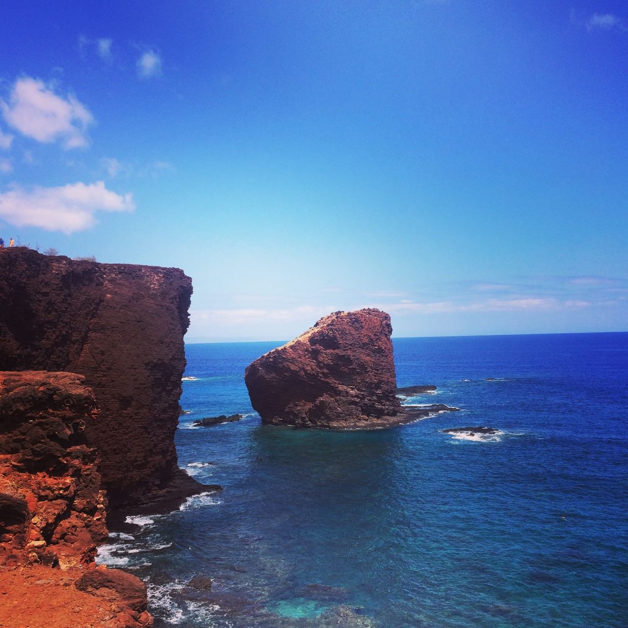
Sweetheart Rock
An eighty-foot sea stack standing about a hundred and fifty feet off the point that divides Mānele Bay from Hulopoʻe Bay, on Lānaʻi’s south shore. The name means Pehe’s hill. Most visitors see it from the cliff trail above Hulopoʻe. You see it from below, at sea level, which is a different rock entirely.
The story most often told is of Pehe, a young woman from Lahaina, and Makakehau, a warrior of Lānaʻi — his name reads as misty eyes, for what her beauty did to him. He kept her in a sea cave at the foot of the Mānele cliffs. He was away for water when a storm ran the swell into the cave and drowned her. He carried her to the top of the stack, buried her there, and threw himself into the surf below.
Worth knowing: when the platform on the summit was examined in 1921, no human remains were found — only seabird bones — and the arrangement of the stones suggests a bird hunters’ or fishermen’s shrine. Accounts also differ sharply from the romantic version popularized in the 1800s. We tell you both, and let the rock stand for itself.

Shark Fin Rock · Kahekili’s Leap
Shark Fin Rock stands in Kaunolū Bay, on the southwestern tip of Lānaʻi. From the approach the rock reads exactly as its name says — a dorsal fin cutting the surface, with the island’s sea cliffs stacked behind it.
The bay behind the fin is one of the most significant places in the Hawaiian Islands. Kaunolū was a fishing village from around the 1400s until it was abandoned in the 1880s, and it holds the largest surviving ruins of a prehistoric Hawaiian settlement anywhere in the state — house platforms, stone shelters, petroglyphs, and Halulu Heiau on the cliff above the bay. It was made a National Historic Landmark in 1962.
Kamehameha I came here to fish. This was his retreat after he took Maui, Molokaʻi and Lānaʻi, and his house platform sat across the gulch from the heiau, where he held ceremonies between roughly 1778 and 1810. The deep water off this coast is the reason — he was a deep-water fisherman, and Kaunolū had a sheltered canoe landing in an otherwise brutal stretch of cliff.
The notch in the cliff face is Kahekili’s Leap. Warriors proved themselves with lele kawa — entering the water feet first, no splash — from somewhere between sixty and eighty feet, depending on which account you read, into about twelve feet of water with a rock shelf at the base. You have to jump out to clear the rocks. It was also used to settle accusations: the accused jumped, and coming up unhurt was the verdict. And it is a leina, a place where spirits leave this world for the next.
Nobody jumps it now, and you shouldn’t. We look at it from the water, which is the safest and honestly the better angle. This is a sacred place — treat it that way.
Honopū Bay · the Three Sisters
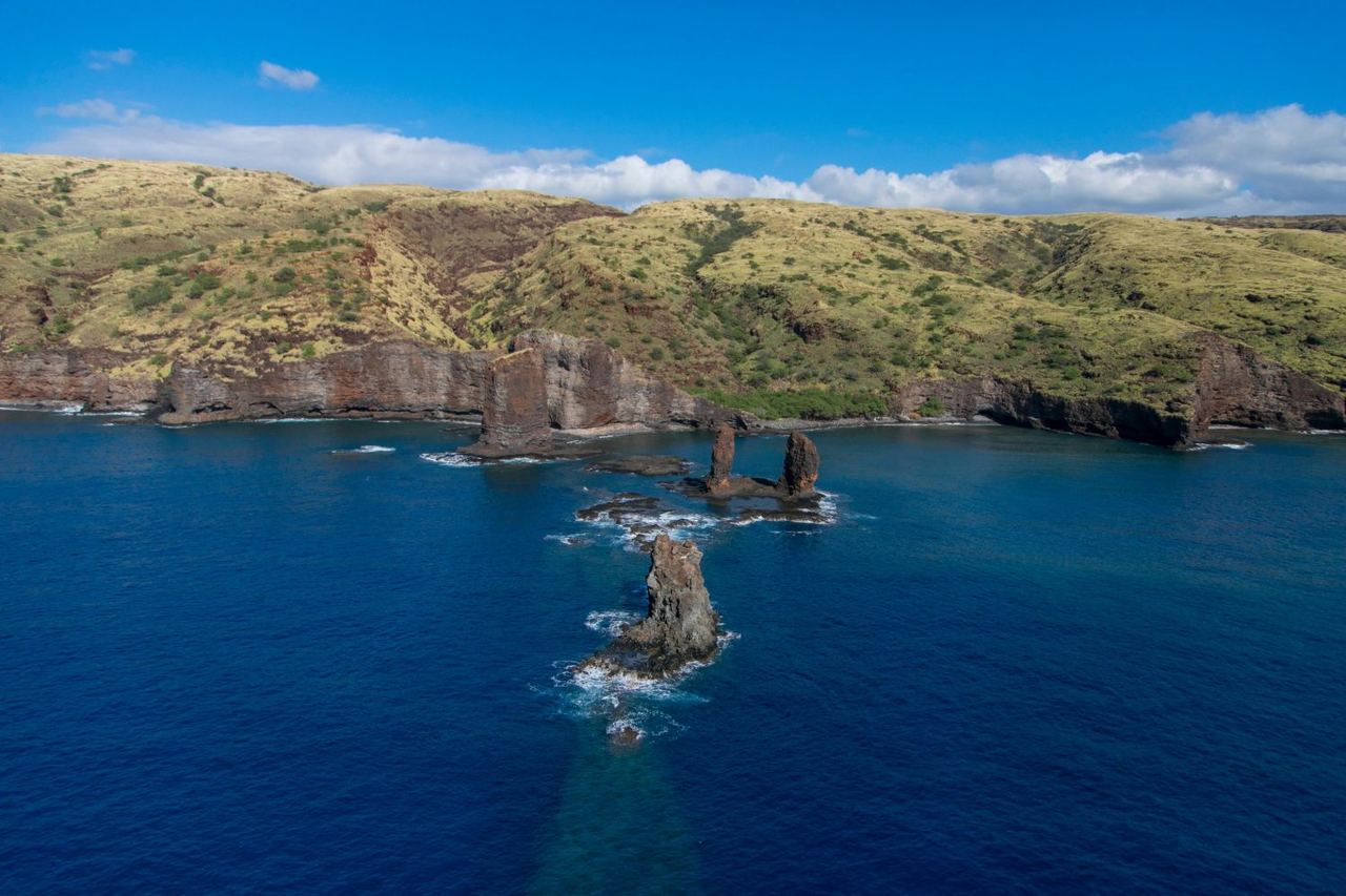
Off Honopū Bay, on Lānaʻi’s west coast, a line of rock needles stands out from the cliffs. Charts call them Nānāhoa. Photographers call them the Pinnacles or the Five Needles. The people who run this water call them the Three Sisters.
There are four stacks in the group. The one nearest the island is the tallest — a round pillar with a slanted top, about a hundred and twenty-eight feet out of the water, with plants growing on the summit. Two mid-sized rocks sit just past it, and the one furthest out is the shortest, shaped, as it happens, like a shark fin.
Nānāhoa was a man. The story says he angered the gods and he and his wife were turned to stone, which is what you are looking at. It’s a different kind of story from Puʻu Pehe — no romance in it, just consequence.
The islets themselves are a state seabird sanctuary. They are closed — nobody lands on them, and that’s the point of them. Below the waterline, though, this is exactly the structure that makes Lānaʻi’s water worth crossing for: vertical rock dropping into blue, which concentrates fish in a way a sandy roadside bay never will.
The Concrete Ship on the Reef
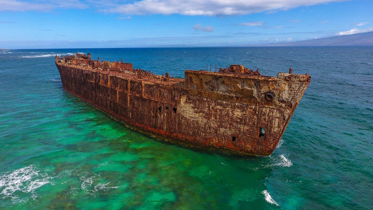
The hull sitting on the reef off Lānaʻi’s windward shore is not a wooden sailing wreck, and it isn’t there by accident in the way most people assume. YOGN-42 is a concrete fuel barge — one of the ferro-cement ships the United States built during the Second World War, when steel was needed elsewhere.
It ran aground on the reef at Kaiolohia, the stretch the maps now call Shipwreck Beach, and it has stayed there ever since — too far out to walk to, too solid to break up. Concrete doesn’t rust away the way a steel hull does. It just weathers.
This coast has collected hulls for a century. The Kalohi Channel funnels wind and swell straight onto the shallow reef, and vessels that lost power in it ended up here. YOGN-42 is simply the one still standing tall enough to see from a long way off.
Green sea turtles, regularly, at both reef stops. We keep our distance and let them come to us.
Spinners, often on the crossing or off the bays. Wild animals, so never promised — but frequently seen.
The ʻAuʻau Channel is prime humpback water, roughly December through April — and it’s why we run Maui Whale Adventures from the same beach in season.
Hawaiʻi sits farther from any continent than any other island chain on earth, and its reef fish evolved in that isolation — roughly a quarter of the shore fish here exist nowhere else. Learn six names and the reef stops being scenery and starts being a place you recognise.
Below: what we see most often off Lānaʻi, Hawaiian name first. Your guide points these out in the water.
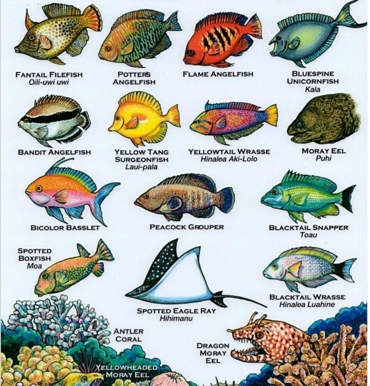
Our own identification chart, drawn for this coast. Names in English and Hawaiian, laid out the way you’ll actually meet them — the grazers in the shallows, the wrasses working the rubble, the eels back in the rock.
Learn six names before you get in and the reef stops being scenery. It starts being a place you recognise.
The colour. Two of these live nowhere but Hawaiʻi.
Solid lemon yellow. Impossible to mistake for anything else.
Blue-grey with a horn on the forehead and two blades at the tail.
Orange barred with steel blue. Found only in Hawaiʻi, and shy.
A black bandit stripe across the eye. Hawaiian endemic, deeper water.
The colour changers. Many shift pattern completely as they mature.
Magenta and green stippling, yellow tail. Never stops moving.
Pale body, dark tail band. Works the rubble for shellfish.
Deep red with black bars. Small, fast, worth the look.
Pink forward, gold aft. Hangs off ledges in small groups.
Head out of a crevice, jaw working. Look, never reach in.
The common one. Open mouth is breathing, not threat.
Nostril horns and leopard markings. Rare and unforgettable.
Pale gold head out of the reef, body still hidden.
Hangs vertical and motionless, pretending to be coral.
The two groupers here were introduced in the 1950s and stayed.
Speckled, with a fan tail it flares when startled.
Rigid box of a body, white spots. Swims with tiny fins.
Brought to Hawaiʻi in the 1950s. Yellow with a dark tail.
The name means elegant. Occasional, and the whole boat notices.
4.5 hours, two guided reef stops, and the whole run past Puʻu Pehe on the way. We go to Lānaʻi, or we don't go.